How drone video can explain location, access, scale and surroundings for real estate developments while respecting planning, safety and accuracy.
- Drone video is most valuable when location and scale influence the real estate decision.
- A useful flight plan follows a narrative rather than collecting random aerial shots.
- Weather, permissions, safety and nearby operations affect production.
- Aerial video should present distance and surroundings accurately.
What aerial video explains better
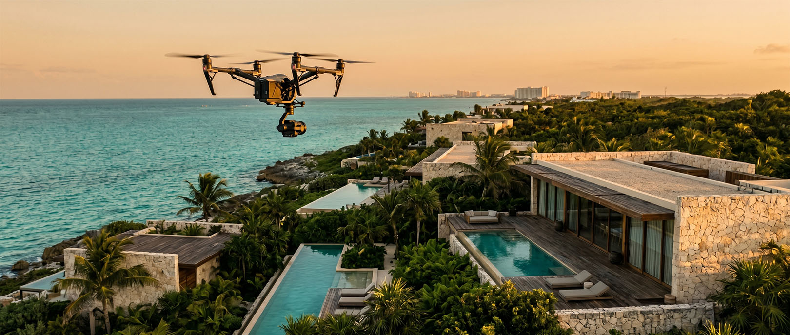
Ground photography can show finishes and human-scale details. Drone video adds geographic context: relationship to access roads, coastline, urban areas, neighboring development and the overall scale of the site.
For buyers who do not know Cancun, Tulum or the Riviera Maya, that context can be as important as the architecture.
Build a flight plan around a story
- Establish the broader location.
- Approach the development through a recognizable access route.
- Reveal the site scale and primary buildings.
- Show relevant amenities, landscape or construction status.
- Finish with a view that supports the next sales message.
Random orbit shots may look cinematic but often fail to explain anything.
Production factors in Cancun and Tulum
- Wind, rain, sun position and rapidly changing tropical weather.
- Airspace, local restrictions and site-specific permission.
- Construction equipment, cranes and active crews.
- Nearby guests, residents, roads and private property.
- Seasonal landscape and current construction condition.
The operator must evaluate each site and flight under applicable rules and safety conditions.
Keep location claims accurate
Editing should not imply that the beach, town center or an amenity is closer than it is. Map graphics, labels and narration should use verified information. When footage shows future phases or neighboring land, the distinction must remain clear.
Combine drone with ground and immersive media
Drone video creates context, but it does not explain interior layout. Combine it with architectural photography, ground video, 360 tours, plans and a well-structured project website. Each format should solve a different part of the buyer’s evaluation.
LUM360 real estate production
We define the aerial narrative alongside the website, sales content and immersive experience. The result is designed to work across project pages, presentations, social edits and remote buyer conversations without separating the visuals from the strategy.
Frequently asked questions
Does every development need drone video?
No. It is most useful when location, scale, surroundings or construction progress materially affect the decision.
Can drone footage be captured in any weather?
No. Wind, rain, visibility and safety conditions may require rescheduling or changing the plan.
Can 4K footage be used on the website?
Yes, but web delivery should use optimized versions and appropriate loading behavior rather than the full production master.
Turn the idea into a useful digital experience.
Tell us about the space, audience and business goal. LUM360 can help define the right combination of web, visual production, analytics and immersive media.